Ontario Nature Blog
Receive email alerts about breaking conservation
and environmental news.
© Lora Denis
I didn’t always envision a career looking at maps on my computer screen, but in today’s environmental sector, so much information can be conveyed visually. In university, a few courses in Geographic Information Systems (GIS) led me to become enamoured with the complexity of this subject and its connection between art and science.
As a GIS Assistant at Ontario Nature, I use GIS technology to uncover and communicate the importance of specific places for conserving biodiversity and fighting climate change. Thanks to this tool, I can answer questions like What species and ecosystems are present in an area? Are they rare, endangered or under significant pressure? Are there known features of cultural significance? Answering this type of information can support a strong case for protection.
At Ontario Nature, GIS technology plays an integral role in the success of our Protected Places Campaign, allowing us to find areas of interest, examine vulnerability, understand terrestrial and aquatic connectivity and share data with colleagues. We can better understand and communicate their value for conserving biodiversity, providing climate refuges for wildlife and enhancing climate resilience, among other benefits. When it comes to protected areas, here is what we are looking for:

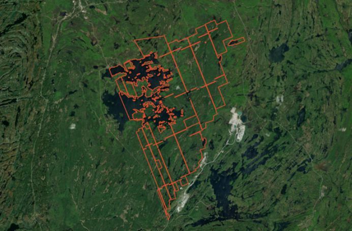
A satellite image can be used to quickly assess the surrounding area for potential threats. For example, an aggregate operation can be seen to the south-east of this candidate area. (Ersi, 2022). These operations damage the natural environment
Connectivity
Habitat loss and fragmentation are the greatest threats to biodiversity, so it is of utmost importance that we identify, maintain, and enhance connection between ecosystems. Interconnected landscapes enable species to move in response to natural and human-caused disturbances and allow for ecological processes to function such as migration, nutrient cycling and adaption to climate change. GIS shows us where we can focus our efforts to maintain or improve connectivity, for example by expanding existing protected areas or protecting new sites near intact ecosystems or bodies of water.

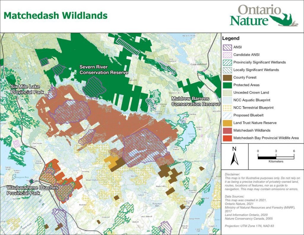
Using GIS, we can visualize areas near the candidate protected area to determine if they will enhance the interconnectedness of the landscape (Ontario Nature, 2022).
Natural Heritage Values
From species at risk and deer yards to wetlands and woodlots, GIS can display the components of an ecosystem as well as the policy layers highlighting their significance. Are there Provincially Significant Wetlands, Areas of Natural and Scientific Interest, or Enhanced Management Areas? What is the mix of unceded Crown land, county forests and properties owned by Conservation Authorities or land trusts? These data are vital to conservation efforts and collective decisions about land use – where resource extraction or development should be allowed, and where it should not.
Cultural and Recreational Values
Not all data can be found online. Communicating with Indigenous communities and local residents provide insightful information about the cultural and recreational significance of candidate areas. Using GIS, I can upload this information to visualize areas of cultural and recreational significance to strengthen the case for the area’s protection. Protected areas benefit people and communities by providing spaces for activities that enrich mental and physical health; as well as providing space for spiritual health and traditional practices such as ceremonies, trapping or fishing.
Threats
Climate change and anthropogenic disturbances are drivers for reshaping biological communities and impairing ecological function. Adding data on forestry, mining, roads, dams and development to a map allows me to assess the conflicts that may arise in the future. This analysis can determine if forestry operations will reduce connectivity to the area, if mining tenure will postpone the area’s protection, or if there are disruptive roads that fragment a natural area.

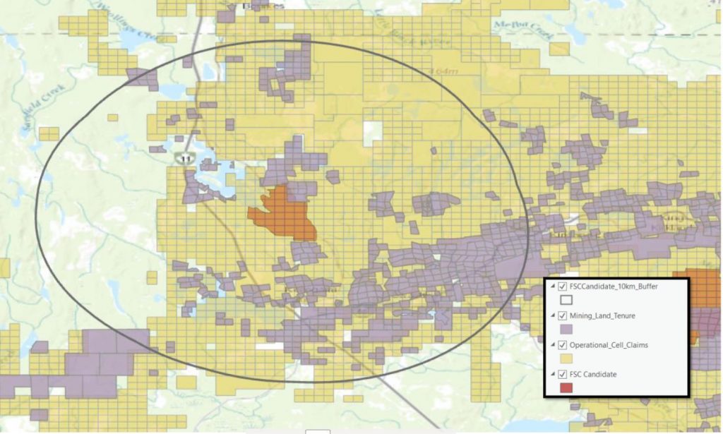
This map displays a candidate area that is significantly complicated by encroaching mining activities. Holders of a mining claim or tenure are permitted to disturb the environment through activities such as drilling, vegetation stripping, and construction of trails/roads (Ontario Nature, 2021).
With GIS I can compile, compare, visually represent and share information about candidate protected areas and prioritize which sites we can advocate for, in partnership with local community members and organizations. Equipped with the maps and measurements, we can work together to urge the government of Ontario to better protect biodiversity and species at risk, increase our resilience to climate change, and maintain a healthy environment for future generations to come.
This project was funded by the Career-Launcher Internships program with the financial support of the Government of Canada through the federal Department of Environment and Climate Change.

Gananoque Lake Nature Reserve © Smera Sukumar
GIS is one technology that has helped us a lot, be it mapping or remote sensing. I mean I’ve been using CivilGEO GeoHECRAS since a long time for creating fIoodmaps. I must say this is a very well structured post.