Ontario Nature Blog
Receive email alerts about breaking conservation
and environmental news.
© Lora Denis
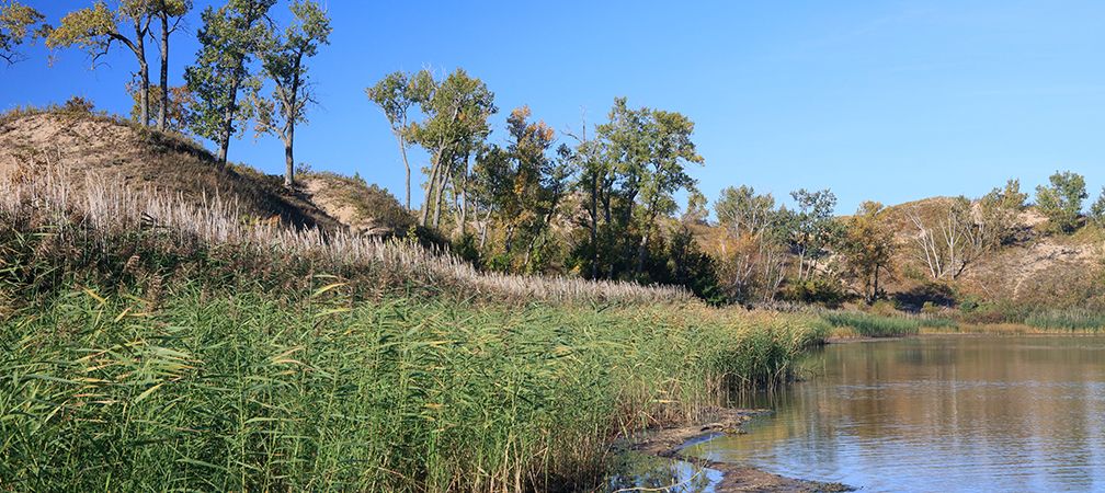
Like many regions across Ontario, West Lake in Prince Edward County is experiencing altered shorelines, habitat fragmentation, and growing development pressure. The 1,903-hectare lake is bordered by the largest freshwater baymouth barrier dune system in the world, found within Sandbanks Provincial Park. West Lake contains a large provincially significant wetland and is home to at least 35 species at risk.
West Lake Community Association (WLCA) is a volunteer non-profit that was formed to engage residents and visitors of the small community with the aim of preserving its uniqueness and protecting West Lake’s biodiverse and fragile ecosystems. WLCA is a member of Ontario Nature’s Nature Network.
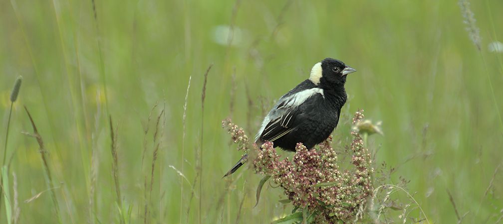
WLCA and Ontario Nature began a collaborative project with a fundamental question: where is the most vulnerable habitat around West Lake? Several major threats are impacting the ecosystems in and around the lake, including shoreline erosion and development pressure. Parts of West Lake are being choked out by rapidly spreading invasive aquatic vegetation. These threats are affecting a variety of species at risk in the area, including Blanding’s turtle, monarch butterfly and bobolink.
Through a collaborative effort to identify where species are most vulnerable in West Lake, partners created habitat suitability models to show where important habitat exists and where habitat restoration and stewardship efforts may be needed.
Our project chose four “representative species” whose habitat needs overlap with those of many other plants and animals in the area: butternut, Eastern meadowlark, Eastern musk turtle and pugnose shiner. These species were selected because together they represent a range of terrestrial and aquatic habitat needs. When the models for these four species were combined, it highlighted these specific vulnerable habitats: healthy woodlands that support butternut, open meadows and fields used by Eastern meadowlark, wetlands and shorelines that are needed by Eastern musk turtles, and clean, vegetated water where pugnose shiner live.
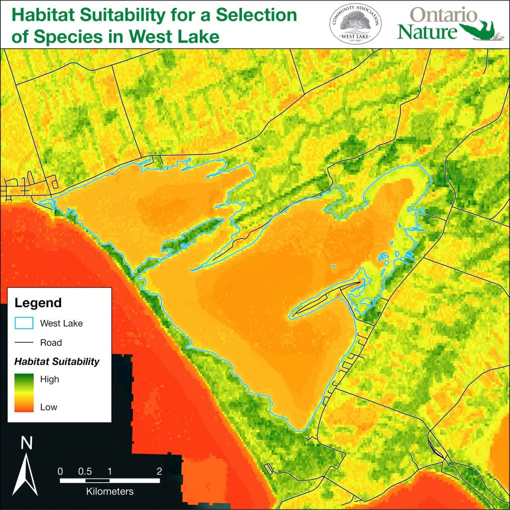
Much of the ideal habitat was near the provincially significant West Lake Wetland, along shorelines in the northeast corner of the lake, and within Sandbanks Provincial Park. These areas may represent priority locations where habitat restoration and conservation efforts could be focused.
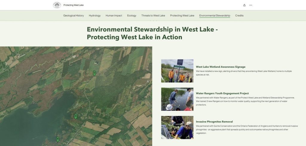
Engaging with the community and sharing knowledge about West Lake was another goal of the project. WLCA works to encourage interest and engagement among residents to help preserve the uniqueness of the West Lake watershed. They have hosted numerous educational workshops and events, including an annual Environmental Symposium, creating signage to raise awareness of the West Lake Wetland, and partnered with Water Rangers on their Youth Engagement project to train youth on water quality monitoring.
Through collaboration, partners have created the West Lake StoryMap, an interactive mapping tool that blends maps and images to share information about West Lake’s history and ecology. The West Lake StoryMap allows residents and visitors to:
By bringing together community perspectives and spatial analyses, the West Lake community has a clear picture of what makes this place special and what threatens its ecosystems. These tools are intended to inspire residents and visitors to get involved in the conservation and protection of West Lake, through shoreline restoration, invasive species removal or by simply learning more about the species that call this area home. With this StoryMap and the continued leadership of the West Lake Community Association, everyone can play a part in keeping West Lake in Prince Edward County healthy for generations to come.
If you or your organization are interested in exploring a conservation or habitat modelling project in Ontario like this, please reach out to Graeme Smith by email at graemes@ontarionature.org or by submitting a request form.
By Graeme Smith and Cathie Coultis

Graeme Smith is the GIS Coordinator at Ontario Nature. He has completed a B.Sc. in biology at Laurentian University and a M.Sc. in environmental and life sciences at Trent University. In his spare time, he enjoys reading, playing board games and exploring the outdoors.

Cathie Coultis is the Chair and Co-Founder of West Lake Community Association. She lives in the hamlet of West Lake with her husband and family dog, enjoys kayaking, cycling, bird watching, gardening, snowshoeing and being active in their rural community.
